A Border on a Map and a Border in Daily Life
A border map identifies jurisdiction, but planning a real route also means checking crossings, transport, services, and local rules before you set out.
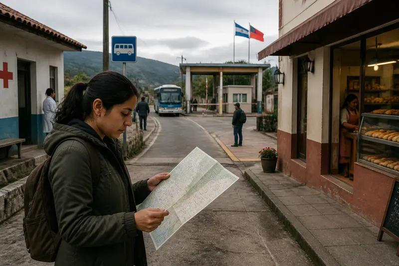
A border map identifies jurisdiction, but it cannot tell you by itself whether a particular crossing fits your route or purpose. To understand a border on a map and in daily life, separate the legal question—who administers a place—from practical questions about access, services, and local rules.
Imagine a fictional town called Loma, where a bakery, clinic, and bus stop sit near an international boundary. A resident, Ana, lives on one side and works at the bakery on the other. Her journey depends on the designated crossing, available transport, and the bakery’s schedule, while the map helps establish which authorities govern each side.
What does a border map establish?
A border map represents the division between jurisdictions. Depending on its scale and source, it can help identify the boundary, nearby roads, settlements, and designated crossings. For a question about official administration, use a current map from the relevant government or other responsible authority.
Check what kind of map you have. A broad political map may simplify local detail; a road map may emphasize routes rather than legal boundaries. If a decision depends on the precise location of a property or service area, consult the authority responsible for that decision instead of treating a general map as definitive.
A map also has limits that matter for travel. It may not show current crossing hours, access conditions, transit schedules, or whether a route is suitable for a particular traveler. Those details require current information from the border authority, transport provider, or service involved.
How can a border change a daily route?
For Ana in the fictional Loma scenario, the route is not simply a line between home and work. She needs a road to the crossing, permission or documentation appropriate to her circumstances, and a way to continue to the bakery. Terrain, transport availability, crossing procedures, and opening times can all affect whether the route works.
Say Ana’s bus does not run after her shift ends. She checks the transit operator’s schedule and learns that the last bus leaves before closing. Her available choices are to arrange another ride, change her shift, or use a different route if one is permitted and practical. The map still identifies the jurisdictions, but the schedule determines which plan she can use.
Before relying on a route that crosses an international boundary, check current requirements with the responsible authorities and transport providers. Rules can depend on a traveler’s circumstances, and a general description cannot replace official guidance.
How should you check a border route?
Use each source for the question it can answer. An official boundary map addresses location; border-authority information addresses crossing conditions; a transit operator addresses service; and a local service provider can clarify where it serves residents. Record the source and date of any information that may change.
- Boundary location: Check an official map. If it clearly identifies the relevant area, use it for general orientation; if the location affects a legal or property decision, ask the responsible authority to confirm it.
- Crossing status: Check the border authority’s current notice. If the crossing is open under conditions that fit your trip, continue planning; if status or eligibility is unclear, contact the authority before setting out.
- Transport: Check the bus or rail operator’s current schedule. If service covers the needed journey and return, use that option; if it does not, consider another permitted route or postpone the trip.
- Road and terrain: Check a route map and current local travel information. If the route is accessible for your needs, proceed with it; if a road, river, or steep stretch blocks access, choose an alternative route.
- Service access: Ask the clinic, school, or other service which locations and users it serves. If the service confirms access for your situation, plan around its stated process; if not, contact the appropriate provider or authority for another option.
- Local terminology: Ask residents how they name the town, valley, or neighborhood when that context matters. If a local name clarifies the place being discussed, use it alongside the formal jurisdiction; if accounts differ, describe the difference rather than assigning one label to everyone.
What do border maps leave unanswered?
Where can you cross the border?
A map may mark a crossing but does not establish its current hours or requirements. Check the responsible border authority’s latest information and confirm that it applies to your circumstances.
Which authority governs a particular place?
An official boundary map can provide a starting point for identifying jurisdiction. For a decision involving a specific property, service, or administrative responsibility, confirm the location with the authority that handles that matter.
How do local ties relate to the border?
Residents may share a market, family connections, or a name for a local area across a boundary. Those ties describe community life, but they do not by themselves determine formal jurisdiction or crossing rules.
What if maps and local descriptions differ?
First clarify whether the disagreement concerns the official boundary, a place name, or a sense of community. Use an authoritative source for jurisdiction and local accounts for how people describe their connections; do not treat one kind of evidence as an answer to the other question.
How do the checks work together?
Imagine Ana has a hypothetical shift ending after the last bus from the bakery. She checks the official map and confirms that the workplace and her home are in different jurisdictions. She then checks the border authority’s information, the transit operator’s schedule, and the bakery’s closing time. The schedule shows no bus home after her shift, so her original plan does not work. She asks whether a permitted ride is available; if it is, she can arrange that ride, and if it is not, she needs to discuss a different shift or route before accepting the plan. The map answers where the jurisdictional line lies; the other checks determine whether her journey is workable.
For a border on a map and in daily life, keep the questions distinct: use official sources for jurisdiction and crossing rules, transport providers for schedules, and local accounts for community names and ties. That separation makes it easier to spot which decision still needs an answer—and which source can provide it.